


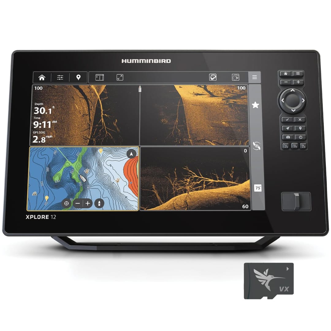
Primary Image


XPLORE 12 CMSI+ Fish Finder
Brand (JDE) Humminbird Product Name XPLORE 12 CMSI+ Fish Finder Product Code 412020-1 UPC 0082324058691 MSRP $USD 2899.99 Amazon ASIN B0DKLKWN6P WalMart WIN 674163850 Overview The XPLORE Series is lightning-quick and laser-focused on anglers’ favorite features. Find your fishing spots faster with included LakeMaster and CoastMaster charts. Sync 10,000 fish spots with custom colors and icons to your phone through a new waypoint management system. Get the clearest picture of what’s below with compatibility for our best sonar, including MEGA Live 2 forward-facing sonar. Connects to Minn Kota products and control them on command – from enabling Advanced GPS navigation to deploying shallow water anchors – with One Boat Network compatibility. With our most advanced technologies and easy-to-use interface, there’s more to XPLORE. Included Components Control head; Power adapter; Unit cover; Mounting bracket; Transducer Feature 1 XPLORE delivers eye-popping detail with a 1280H x 800V display. See the incredible detail of sonar and chart images that will ensure you never miss a thing. Control it all using the touchscreen or the keypad—it's up to you. Feature 2 See the world below like never before with a crystal-clear Side Imaging viewing out to 200 feet on either side of your boat. You'll unlock more fish and structure with 20% more detail and 60% more range capability than MEGA Side Imaging sonar. Feature 3 Get unprecedented underwater clarity with Down Imaging coverage down to 200 feet below your boat. You'll unlock more fish and structure with 20% more detail and 60% more depth capability than MEGA Down Imaging sonar. Feature 4 Before you cast, know what's down there thanks to highly-detailed fish arches and a clear view of fish-holding structure and the bottom. Powered by our proprietary, Low-Q CHIRP transducer, Dual Spectrum offers two ways to search; Wide Mode for maximum coverage and Narrow Mode for focusing on the slightest detail. Feature 5 Our enhanced basemap provides you with a clear view of underwater terrain and surrounding points of interest so you can fish and navigate with total confidence. Identify buoys, day markers, hazards, marinas, contours, depth markers and much, much more. Includes charts of more than 10,000 lakes, plus coastal coverage for the continental U.S. Feature 6 Humminbird provides the most complete offering of premium chart options to anglers everywhere. Get a complete view of the world below with optional charts from Humminbird's LakeMaster® and CoastMaster™ products, as well as your choice of compatible Navionics® charts. Feature 7 Navigate over 13,000 lakes, waterways, and coastal waters in the United States and Canada safely and with confidence. Tools like 1-foot contours, depth and shallow water highlights help you traverse waters with certainty. Feature 8 Included with all LakeMaster® and CoastMaster® charts, SmartStrike™ highlights the best fishing spots based on real-time conditions—right from your map card Feature 9 Create real-time maps of your fishing spots, with access to patented Humminbird® LakeMaster® features. Map depth contours, bottom hardness and vegetation as you drive your boat. Comes standard with eight (8) hours of built-in recording time and is compatible with AutoChart Zero Line SD cards for virtually endless AutoChart Live mapping capacity. Feature 10 Many Humminbird models seamlessly integrate and communicate with Minn Kota and Cannon products to unlock more features and capabilities for anglers everywhere. Make the most of your time on the water with the exclusive boat control and fish-catching features of the One-Boat Network. Feature 11 High-speed Ethernet allows you to build a powerful, professional-grade fishing system. Easily connect multiple fish finders, or upgrade to add-on technologies like Minn Kota i-Pilot Link and Humminbird CHIRP Radar. Feature 12 Take control right from the screen of your Humminbird with wireless communication to compatible Talon and Raptor shallow water anchors, as well as Cannon Optimum downriggers. Additional features include wireless software updates from the Humminbird One-Boat App. Feature 13 Connect an accessory NMEA 2000 network to your control head for even more information; from boat performance to weather and water conditions, make sense of it all with NMEA 2000 networking. Feature 14 Watch fish move, react, and strike your lure with the next-gen clarity of MEGA Live 2 in Forward or Down Mode, now with real-time zoom (Sold Separately). Feature 15 Once Update 6.090 is installed, connect your XPLORE, APEX, or SOLIX G3 to Wi-Fi, and download future software updates over Wi-Fi. Download updates on one device and install them on all connected units, making individual unit updates a thing of the past. Feature 16 Capture screenshots and record the imaging on your screen 30 seconds into the past, or up to two minutes into the future. Then easily view, transfer, edit, and share your best on‑water moments using the One‑Boat Network App. Feature 17 If in-dash mounted, an external GPS antenna is required to ensure accurate positioning and navigation. Feature 18 3-Year Limited Warranty with Registration Series XPLORE Display Size - Diagonal 12.1 in Display Pixel Matrix 1280H x 800V Memory Card Slot Dual Micro SD Features - Bluetooth
- Built In GPS
- Built In Mapping
- Down Imaging
- MEGA Imaging
- MEGA Imaging+
- Networking
- Side Imaging
- Touch Screen
- Wi-Fi
- Dual Spectrum CHIRP
Power Draw 2.4 Amps Power Input 10.8-20 VDC Power Output Peak-to-Peak 8000 Watts Power Output RMS 1000 Watts Screen Snap Shot Included Mount Standard Gimbal Mount-Standard Size 14.145 in W x 8.911 in H x 3.989 in D Mount-Optional In-Dash Mounting Kit Mount-Optional Size 14.145 in W x 8.911 in H x 3.989 in D Transducer Mount Location Transom GPS Chartplotting Included GPS Receiver Internal GPS Trackplotting Not Supported Waypoints, Routes, Tracks/Points 10,000, 50, 50/20,000 NMEA2000 Included Target Separation 2.5 in Upgradable Software Yes View Preset Keys Yes X-Press Menu System Yes Custom Digital Readout Yes Custom View Selections Yes Display Colors Grayscale 24-Bit Display Type Color TFT Speed Included Temperature Built In Temperature Alarm Yes Temperature Graph Yes Transducer Included XM 14 HW CMSI T Humminbird Basemap Included Warranty Three-Year Warranty with Registration Country of Origin UNITED STATES Prop 65 Text This product can expose you to chemicals including 1,3-Butadiene, which are known to the State of California to cause cancer and birth defects or other reproductive harm. For more information go to www.P65Warnings.ca.gov. Compatible With - MEGA 360
- MEGA Live
- MEGA Live 2
- Minn Kota Built-In MEGA DI
- Minn Kota Built-In MEGA SI
- Minn Kota Talon/Raptor
- NMEA 2000
- One-Boat Network
- Minn Kota i-Pilot Link
- Minn Kota US2 Sonar
- Radar
MEGA 360 Imaging Compatibility Yes MEGA Live Compatibility Yes LakeMaster Compatibility Yes CoastMaster Compatibility Yes Navionics Gold/HotMaps Compatibility Yes Navionics Platinum + Compatibility Yes Platinum Compatibility Yes Minn Kota i-Pilot Link Compatibility Yes Minn Kota Talon Shallow Water Anchor Compatibility Yes Radar Compatibility Yes 5-Port Ethernet Switch Compatibility Yes AIS Compatibility Optional Autopilot Compatibility No Heading Sensor GPS Compatibility No HDMI Compatible No Sonar-Standard - Dual Spectrum CHIRP
- MEGA Down Imaging+
- MEGA Side Imaging+
Sonar-Coverage 20°, 42°, 60°, (2) 86° & (2) 55° @ -10dB Sonar-Optional 50/83/200 kHz, Airmar High, High Wide, Medium, Medium Wide, and Low CHIRP - Frequencies Supported - Full Mode (150-220 kHz)
- Narrow Mode (180-240 kHz)
- Wide Mode (140-200 kHz)
Sonar-Frequencies Supported 50/83/200/455/800 kHz, HW DSC CHIRP, and MEGA Depth-Sonar - 1,200 ft (standard transducer)
- 3,500 ft (optional 50 kHz)
CHIRP - Imaging-Frequencies Supported - 455 kHz (420-520 kHz)
- 455 kHz SI+ (405-505 kHz)
- MEGA SI+ (1050-1175 kHz)
Depth-Down Imaging - 400 ft (455 kHz)
- 200 ft (MEGA)
Range-Side Imaging (Side-To-Side) - 800 ft (455 kHz)
- 400 ft (MEGA)
Sonar Recording Included Carton Length 12.5 Carton Width 18.5 Carton Height 11.5 Shipping Weight (lbs) 15.2 Units per Container [Case Pack] 1 Case Cartons Per Layer 6 Case Cartons Per Pallet 30 Layers per Pallet 5 Product Length 14.15 Product Width 3.4 Product Height 8.46 Product Weight (lbs) 6.31